
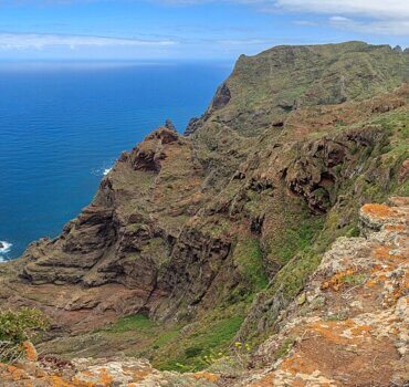
Coast at Chinamada, Tenerife
Geology tends to move very slowly, until it doesn’t.
Janine Krippner
Below our feet are enormous tectonic plates moving at around the speed fingernails grow. Depending on location, there may also be molten magma, faults that will one day produce earthquakes, and for those of us who live on slopes, soil and rock that may one day move downhill. As geologists, it is our collective job to understand these processes and how they might impact us.
Not long ago, we experienced Cyclone Gabrielle, which led to around 140,000 landslides. Landslides also happen to cause the most fatalities out of any geologic hazard in Aotearoa. As with other hazards, understanding when and where they may happen is crucial in preparing ourselves so that we can move people out of the way, prevent injury or death, and recover faster. We have increasingly powerful computing technology to help us to.
After working with researcher Sergio Alfaya over the past month with the GeoTenerife programme, we will be heading into the field to hunt down what we call mass-wasting events. This is a term that basically encompasses soil and rock moving downhill, whether it be a landslide or a rockfall, or any other process where terrain becomes unstable and shifts downslope.
.jpg)
Cyclone Gabrielle. MODIS Land Rapid Response Team, NASA GSFC, Public domain, via Wikimedia Commons
His research has been using Machine Learning to work out which areas of the Canary Islands are most likely to experience these events. Important factors for when and where these processes may occur are the slope – how steep the land is – elevation, geology – the rocks – vegetation and rainfall.
In Machine Learning we create a type of AI to work through large amounts of information, in this case, where past landslides match patterns in those five factors. This is called model training, and in this case, he used a database of well over 1000 landslide events across the Canary Islands. After months of work, he managed to get this to around 90 per cent accurate, a great result especially given the complex terrain.
A surprising find was that elevation is an important factor here, when the assumption was that vegetation and rainfall would be. Through research like this, we understand more of the metaphorical puzzle that is the land we live on.
Over the next couple of weeks we will be going into the field to check out where more recent events have happened, mostly rockfalls in this case, to gather information that we can’t see on a computer screen. Combining computing power with human experience makes this research all the more powerful and will hopefully contribute to helping emergency management planning on the islands.
This is a great example of how new technology can help us work through so much more information to gain more insight into our planet, and guide smarter decisions on how we prepare, build, and respond to our changing landscapes.
As with any hazard, being prepared by understanding the hazards around our homes and having an emergency plan can make a huge difference when it matters most. The National Emergency Management Agency Civil Defence is a good source of more information.

Coast at Chinamada – Tenerife. Public domain, via Wikimedia Commons